Nature Walks

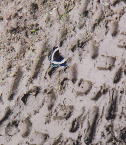
White Admiral Butterfly soaking up water and minerals from mud
This experience will increase your ability to:
Find Wildlife
Learn techniques to locate wildlife in their natural environment and will find animals on our walk!
Learn From Animals And Plants
See animal behavior, animal and plant adaptations for survival, habitats, animal-plant interrelationships
Protect Nature For The Future
Learn how you can ensure there will be biodiversity of wildlife in the future
Walk Topics
Choose one, a combination or create your own!
- Birds
- Mammals
- Insects
- Reptiles and Amphibians
- Animal Tracking
- Stream Life
- Plants (herbaceous and trees)
You will bring
Your senses, sturdy shoes, clothing in layers, raincoat if needed, water, an open mind

Short-tailed Weasels
Photo by Fotolia
What is a Northern Forest?
The Northern Mixed Forest in the Hardwick region represents a transition between the Central Deciduous Hardwood Forest further south (mostly maples, beech, birches, hickories and few conifers) and the Northern Boreal Forest further north (mostly spruces, fir, Tamarack, aspen, birch). Here, our forest is predominantly maples, beech, birches, aspens, spruces, fir, Tamarack, and cedar in various proportions. The Hardwick Trails contain two northern natural communities: The Rich Northern Hardwood Forest (mostly hardwoods, few conifers), and The Lowland Spruce-Fir Forest (mostly conifers mixed with hardwoods). It is fascinating to see this combination of trees in the Spruce-Fir Forest, especially in the fall when the brilliant Red Maples and Golden Aspens are backed by the darker green evergreens.
History of the Hardwick Trails
The Hardwick Trails are six miles of non-motorized nature and recreational trails located behind Hazen Union School, Hardwick, VT, on town and private land. Local people first visualized the Hardwick Trails as cross-country ski trails. Funded by a grant from the Department of Forest Parks and Recreation, the trails were designed by John Morton, and construction was completed by students and staff of Hazen Forestry, Hazen Union School along with hired excavators. Later the Hardwick Trails Committee formed to oversee care of the trails and create public events. The trails are maintained by the Hardwick Trails Committee and the Green Mountain Technology Career Center (GMTCC) adjacent to the trails (Hazen Forestry joined this group). During the winter, the trails are groomed, making cross-country skiing and walking available with or without snowshoes. Each trail is well marked with maps showing locations at trail intersections. Trail maps, plant lists, bird lists, and other Information including announcements of trail events are provided by the Hardwick Trails Committee at the trailhead.

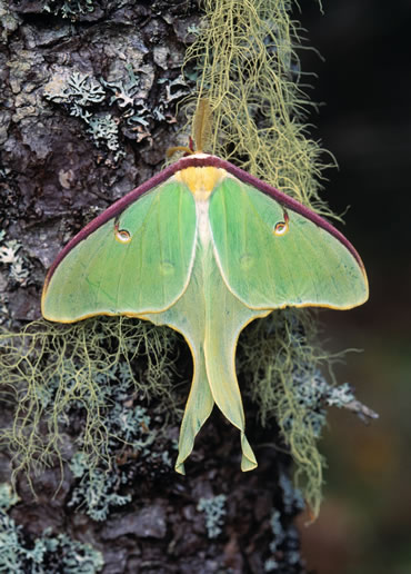
Luna Moth
Photo by Fotolia
Who uses the Hardwick Trails?
These trails are used by hikers, mt. bikers, cross-country skiers, and snowshoers. They also provide an outdoor classroom and a working forest. Hazen Union students use the trails to learn about ecology. Students from GMTCC study tree identification, forest management, and run a maple sugaring operation on the trails. Their sugar house is near the trailhead and their maple syrup can be purchased at the center.
The Terrain of the Hardwork Trails
The eastern side of the trails winds through large White Pines beside the Green Mountain Technology and Career Center (GMTCC) into a spruce-fir forest with a Hemlock ravine above Eaton Brook. Going up and down gentle hills, when the trail reach the highest point looking west you can see the Worcester Range of the Green Mountains through the trees. A narrower loop trail leads through the shaded forest eventually coming to an open Blackberry patch. To the north is a wetlands. The northwest loop trail is heavily treed and leads back to the wetlands. (There is a new trail that branches off this loop trail leading down to Hardwick Lake.) The trail back goes through a spruce-fir nursery, more spruce-fir woodlands, and then into the Rich Northern Hardwood Forest Area. This is where the GMTCC sugarbush is located. Once more the trail enters a Hemlock ravine with a spectacular steep look at Eaton Brook. As the trail ends at the high school, to the right is the GMTCC sugarhouse.
